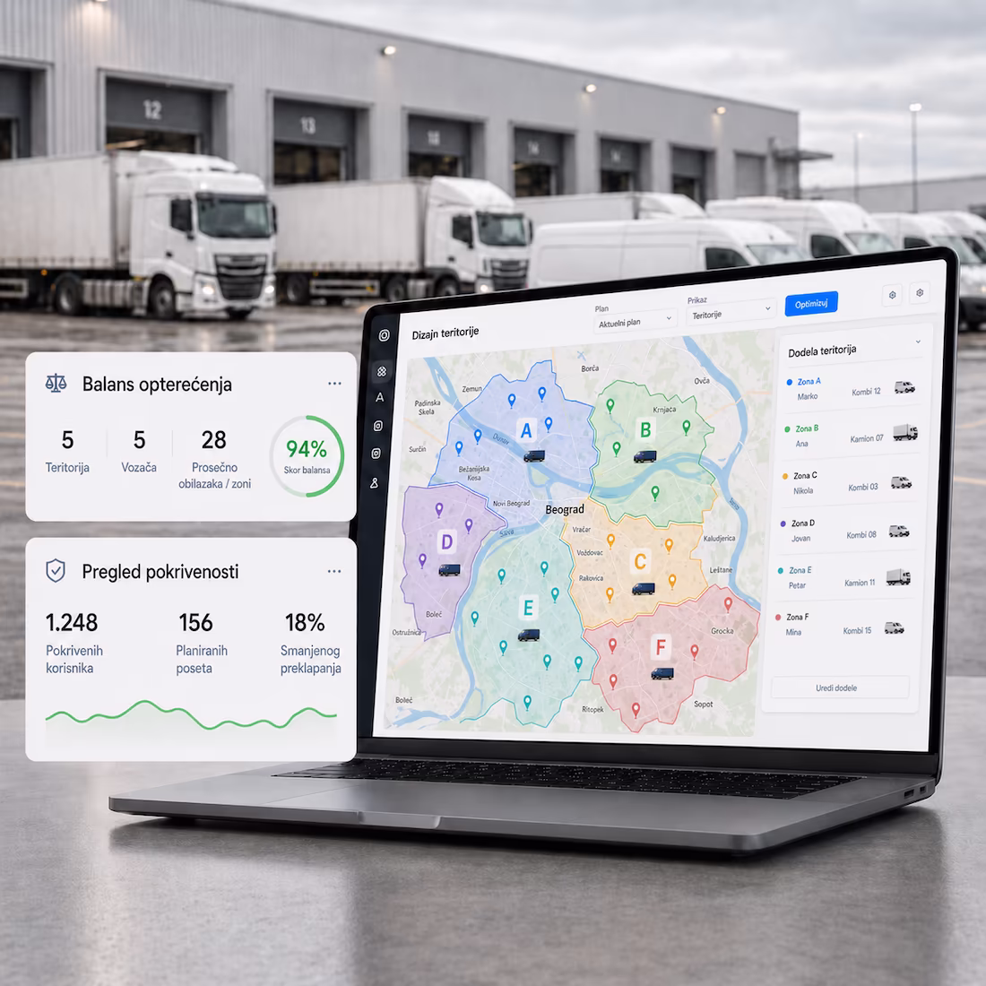
Territorial network design
Spatial and analytical model of territories
Eliminate team overlaps and wasted mileage.
Balanced zones based on customer count and sales.
Clear GIS visualization for easy network control.
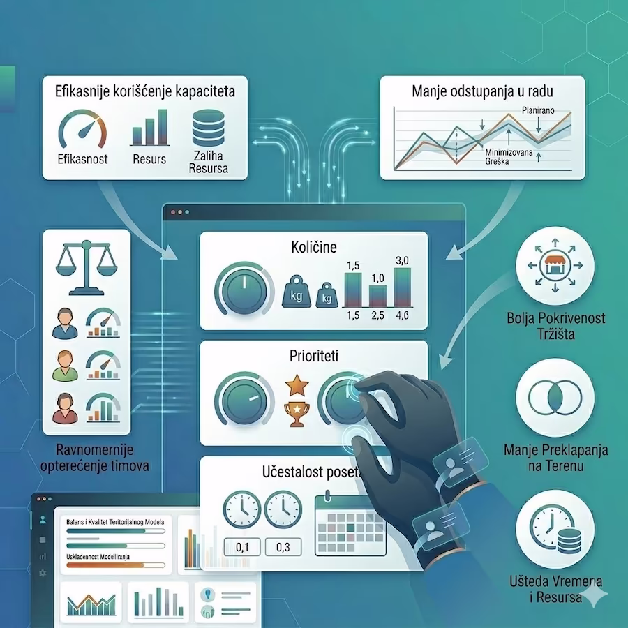
Modeling business constraints
Parameters, constraints and distribution rules for design
Group locations by priority and visit windows.
Align zones with actual workforce capacity.
Simulate different scenarios before finalizing.
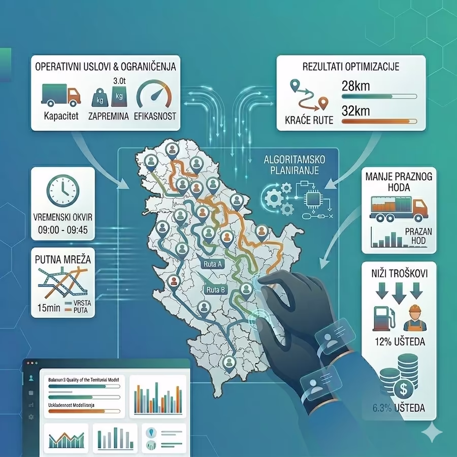
Intelligent route optimization
Algorithmic route planning by constraints
Automatic daily route generation within zones.
Direct link to field navigation for drivers.
Measurable time and fuel savings through work corridors.
Core Features
Frequently Asked Questions
Yes. One of the advantages of digital territory design is the ability to compare multiple scenarios. The system can show how different territory divisions affect the number of visits, team workload, mileage, working time, and market coverage. This makes it easier for management to see which division is truly best for the business, instead of making decisions based only on experience or manual estimates.
Yes. Once the division of territories into regions or zones has been adopted, MobTrack24 Territory and Route Design can also prepare route proposals for sales representatives, goods delivery, or field teams. Routes can be planned for each vehicle, each working day of the week, and each planning period within the month. The client can receive the routes in various digital formats, and they can also be uploaded into the MobTrack24 system. They then become available through MobTrack24 Navigator, which guides the driver along the planned route and helps them visit all locations in the intended order.
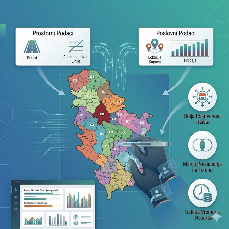
The system can automatically propose territories based on business and spatial data, without the need to draw everything manually. It can take into account customer locations, sales, number of visits, quantities, priorities, visit frequency, team capacities, and other business rules. The user can then review the proposal on the map, compare results through charts and reports, and further adjust the territories if needed.
MobTrack24 Territory and Route Design is intended for companies with sales, distribution, service, or field teams that want to better organize who covers which territory, which locations are visited, and in what order. If routes often overlap, some teams are overloaded while others have less work, and vehicles cover unnecessary kilometers, territory design helps distribute work more evenly, reduce empty running, and make better use of people, vehicles, and time in the field.
In territory and route design, AI, mathematical models, and spatial analysis help divide territories more logically and evenly. The system can analyze customer locations, sales, quantities, visit frequency, team workload, and other conditions defined by the user. Based on this, it proposes a division into regions or zones that reduces overlap, unnecessary mileage, and uneven team workload.
Better territory and route design can reduce field overlap, total mileage, fuel consumption, driving time, and inefficient use of vehicles and employees. When territories are logically defined, teams have clearer work zones, routes are shorter, workload is more balanced, and management can more easily monitor the quality of distribution. The result is better market coverage, lower operating costs, and more efficient work by sales, distribution, service, or field teams.
As the result of a MobTrack24 Territory and Route Design project, the client receives a proposed division of the territory into regions or zones, with a clear definition of which facility, customer, location, or point of sale belongs to which zone. This division is created using mathematical models, spatial data, and business rules defined by the client, such as number of visits, quantities, priorities, team workload, and other conditions. The result is displayed on a map, and the client also receives a web GIS map where the proposed division can be clearly viewed. At management level, the proposal is then analyzed, discussed, and adopted as the final solution.