Automatic territory design using advanced models
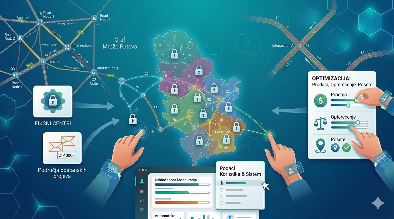
MobTrack24 enables the automatic design of territories using powerful algorithms and advanced models that adapt the territorial division to real business rules, constraints and priorities. The system optimizes territories according to one or more criteria, such as sales, load, number of visits and other relevant indicators, with the possibility of defining minimum and maximum quantities per territory. The user can fix the selected territorial centers, while the system optimizes the remaining parts of the network, and if necessary, uses the road network graph for a more precise calculation of the cost of the road. Additionally, it is possible to favor frequent customers by adjusting the ratio of costs, time and distance. The results are monitored through a map, graphs and detailed reports, which enables a faster assessment of the quality and operational applicability of the obtained solution.
MobTrack24 enables the automatic design of territories using advanced models that combine optimization, business constraints and spatial parameters into a unique solution.
The combination of algorithmic optimization, definition of priorities, control of deviations and detailed reports enables faster making of better territorial decisions and more efficient distribution of resources.
Automatic formation of territories according to several criteria
MobTrack24 automatically generates territories based on predefined parameters and business rules. Optimization can be based on one or more criteria for each location, such as sales, load, number of visits or other weights important for the organization of work. In this way, territories are formed not only spatially, but also in accordance with realistic business goals and a more even distribution of potential or activities.
Advanced modeling of constraints and priorities
The system enables the definition of minimum and maximum quantities per territory so that the distribution remains within the desired range. When the data does not allow full respect of the given limits, the optimizer finds the best possible solution while minimizing deviations. In addition, the user can fix certain territorial centers, while the system optimizes those that are not fixed, as well as give greater importance to customers who are visited more often by adjusting the ratio of costs, time and distance.
A more realistic model with the cost of the trip and a detailed analysis of the solution
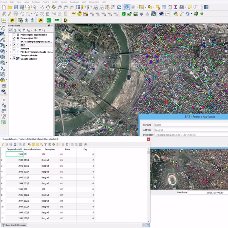
When it is necessary to improve the accuracy of the model, MobTrack24 uses the road network graph to calculate the cost of the road in the optimization process. The obtained territorial solutions can be analyzed through visualization on the map and graphs, as well as through three types of reports: report on customers, report on territories and report on the entire solution. This gives the user a clear overview of quantities, deviations, travel times, distances, costs and customer assignment status.
Result
Automatically created territories that are balanced, business relevant and aligned with real constraints, priorities and conditions of work in the field.
Key Benefits
Automatic creation of territories with business logic
The system generates territories based on defined parameters, without the need for complete manual work and distribution.
Optimization by multiple criteria and constraints
Territories can be shaped according to sales, load, number of visits, minimum and maximum quantities and other business rules.
Greater precision through fixed centers and cost of travel
It is possible to keep selected territorial centers, while the system optimizes the rest of the model using the road network graph.
A clear check of the quality of the solution
Map, graphs and detailed reports allow a quick assessment of the balance of territories, deviations and operational applicability of solutions.