Data management for precise territory design
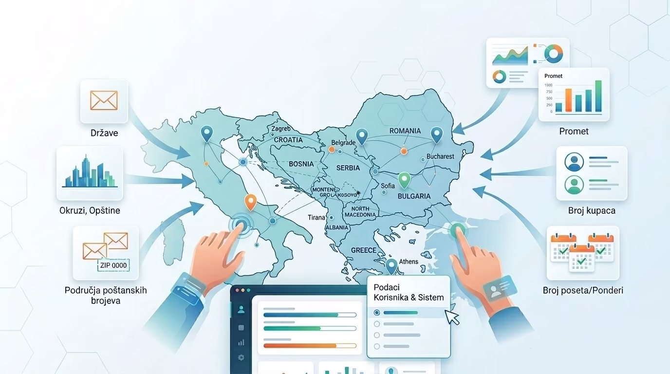
MobTrack24 Territory design enables the preparation and management of data that is necessary for quality planning and territory design. Territories can be formed by directly assigning individual customer weights to a specific territory or by aggregating data into geographic entities such as states, counties, municipalities, statistical districts, or zip code areas. The system provides the necessary geographic and analytical data for work, but at the same time it enables the use of data provided by the user himself. In this way, organizations get a reliable basis for territorial planning, with the flexibility to use existing internal data sources and adapt the process to their own business needs.
MobTrack24 Territory design enables the preparation and management of geographic and analytical data that are necessary for quality territory design.
Flexible use of system and user data enables territories to be planned based on realistic business parameters and the concrete spatial structure of the market.fl
Flexible data entry and organization
MobTrack24 Territory design allows territories to be planned based on directly assigned weights to customers or through data aggregation into pre-defined geographic objects. Such an approach gives the user the freedom to choose the level of detail that best suits the business model, the market and the organization of sales or field activities.
Geographic data as the basis of quality design
For territory planning purposes, geographic data provided by MobTrack24, as well as data owned by the user, can be used. The system supports work with different territorial levels, such as states, districts, municipalities, statistical circles or postal codes, thus providing a quality spatial basis for further analysis and distribution of territories.
Analytical data tailored to business goals
In addition to geographic layers, MobTrack24 Territory Design allows the use of analytical data necessary for territory design, whether provided by the system or entered by the user. In this way, the territories can be based on real business parameters such as the number of customers, turnover, market potential, number of visits or other weights relevant to the optimization of coverage.
Result
A reliable and flexible database of geographic and analytical data that enables more precise, faster and more business-relevant territory design.
Key Benefits
Support for different models of territory formation
Territories can be designed directly at the customer level or by aggregating data into broader geographic entities.
Use of system and user data
MobTrack24 Territory Design supports combining data provided by the system with data from internal user sources.
Working with different geographic levels
It is possible to plan the territory through states, districts, municipalities, statistical circles, postal codes and other spatial units.
A better basis for decision-making
Territory design is based on relevant geographic and analytical parameters, not data-free estimates.